Oakland Ecology Master Plan
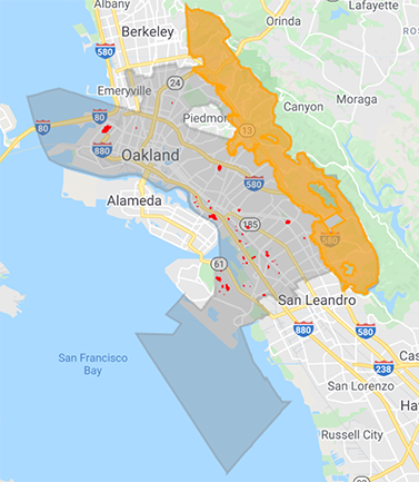
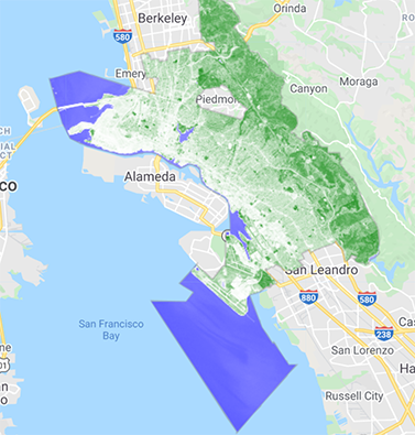
A spatial visualization of different factors affecting the implementation of an urban forestry master plan
This map will be used for the Vegetation groups final project for LA130 @UC Berkeley. It is meant to be a spatial visualization of different factors affecting the implementation of an urban forestry master plan. The master plan aims to minimize fire risk, create equitable access to green space, reduce hotspots of the heat island effect, indicate opputunities for solar/green roofs (by showing current green space), and highlight areas that would benefit the most from urban greening. Created by Lucas Springer using Earth Engine & QGIS.
Note: webmap is not mobile compatible
https://lucasspringer.users.earthengine.app/view/oakland-vegetation-master-plan